EARTH OBSERVATION AND DIGITAL AGRICULTURE TECHNOLOGIES AS DATA SOURCES FOR THE FUTURE CAP MONITORING
From the 22nd until the the 25th of September 2022 the 10th International Conference on ICT in Agriculture, Food & Environment took place in Athens, Greece. HAICTA 2022 (HAICTA 2022 – 10th International Conference on ICT in Agriculture, Food & Environment) aims to bring together professionals, experts and researchers working in Agriculture, Food and Environment, emphasizing on the applicability of ICT solutions and innovations to real industry cases and the respective challenges. Based on the work of NIVA’s WP3 a paper was created by our partners Neuropublic and IGN. The paper “Earth Observation and Digital Agriculture Technologies as data sources for the future CAP monitoring” provides a short analysis on how and in what extend the satellite-based technologies and smart farming systems can act as new sources of information towards the realization of future CAP objectives. The report focuses on the integration of these new technologies in support of advanced decision making for the regional/national Integrated Administration and Control Systems (IACS).
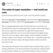
UC2 AUTOMATED PARCEL PRELIMINARY BOUNDARY DETECTION AND DELINEATION PROTOTYPE RESULTS ON SENTINEL2 1 METRE SUPER RESOLUTION IMAGES AVAILABLE
UC2 Prefilled application seeks to make it easier and more accurate for farmers to annually declare their land by reducing the time needed to draw the new parcels boundaries or update the existing ones, thus, prevent mistakes with input of the data on crops grown. Sinergise invites You to read the technical aspects and findings behind the test of Sentinel2 1 metre super resolution image, produced by DigiFarm, over an area of interest in Lithuania for the second part of March 2022.
UC2 PREFILLED APPLICATION AUTOMATED PARCEL PRELIMINARY BOUNDARY DETECTION AND DELINEATION PROTOTYPE TECHNICAL DESCRIPTION AVAILABLE
UC2 Prefilled application seeks to make it easier and more accurate for farmers to annually declare their lands by reducing the time needed to draw the new parcels boundaries or update the existing ones, thus, prevent the mistakes with input of the data on crops grown.
UC4A CO-DESIGNING A SMARTPHONE APP FOR AND WITH FARMERS: EMPATHISING WITH END-USERS’ VALUES AND NEEDS
Co-designing a smartphone app for and with farmers: Empathising with end-users’ values and needs Dr. Ursula Kenny and Áine Egan, Teagasc, recently published in Journal Rural Studies, an article related to the findings of the NIVA project (IE team).